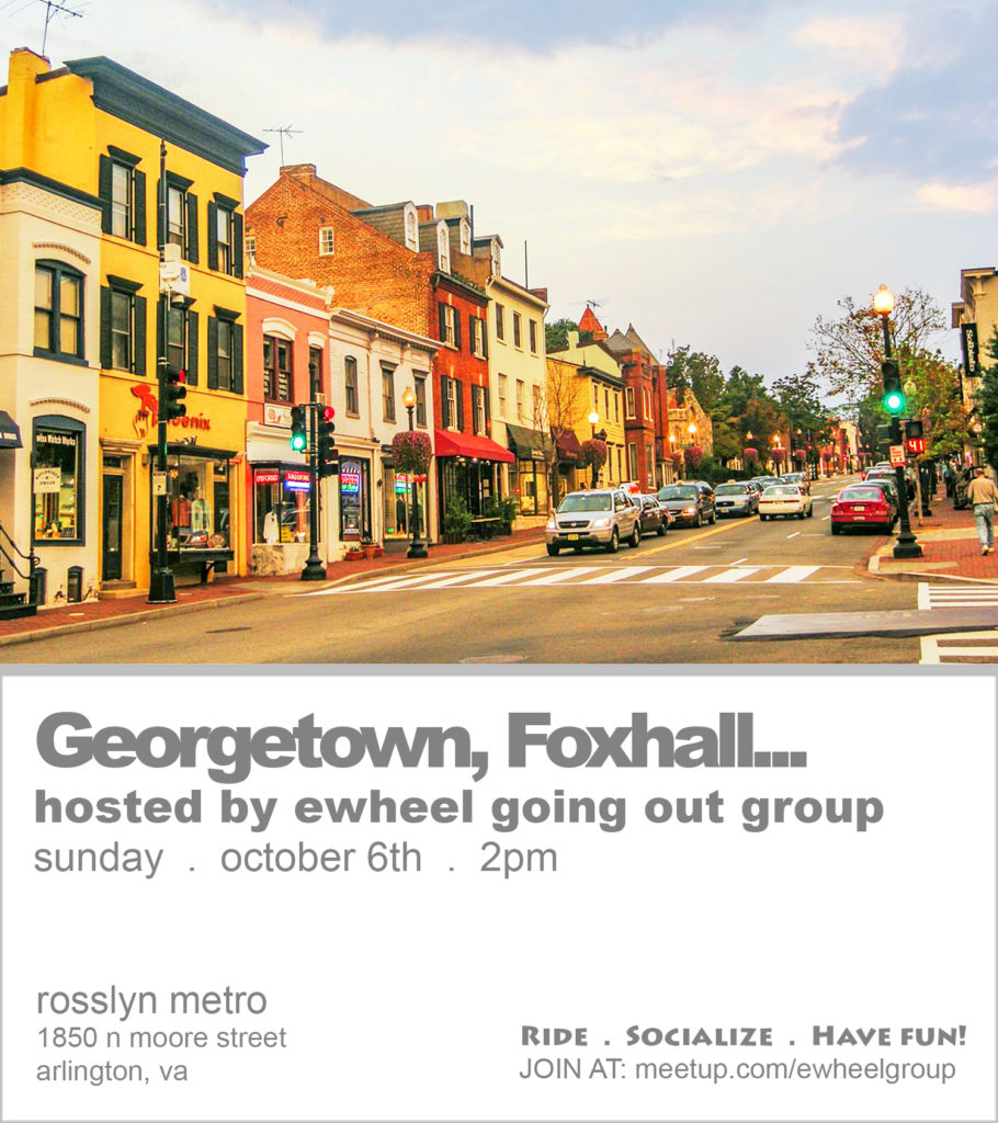
Georgetown, Foxhall, Wesley Heights, Burleith – Hillandale, & Rosslyn Tour! – eWheel Going Out Group
.
< Click here to go back to RSVP page
*** It’s a great day for an ewheel ride. See you there! ***
UPDATE #1: The email with my cell no. has been sent to the yes RSVPs. TEXT me if you need to. If you do not see my email, check your spam folder, and also make sure your email and Meetup settings allow for you to always receive messages from the organizer. If it’s not there, send me a message through my Meetup profile with YOUR CELL NO. so I can text you back. See you there!
—
Let’s get together for our final ride of the year!
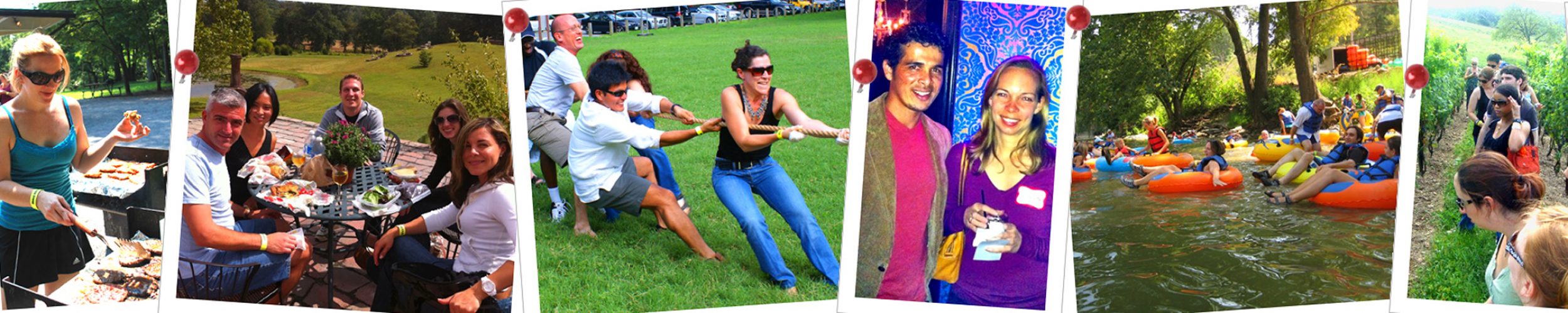
New riders, come join us for the first time! Riders from previous Meetups (Adolphus, Aian Neil, Anibal, Ben, Bob, Brandon, Chris, Connor, Dave, Declan, Edwin, Erwin, Haitao, Heather, James, Jeff, Jeremy, Jessica, Joe, John, Jonathan, Kevin, Kris, LeRoy, Loren, Lutalo, Mark, Megan, Melissa, Michael, Nick, Phil, Rakesh, Raul, Richard, Riley, Robert, Rodney, Shelly, and Steven), come join us again!
We’ll tour Georgetown, Foxhall, Wesley Heights, Burleith – Hillandale, & Rosslyn neighborhoods and stop numerous times along the way to enjoy the sites, memorials, neighborhoods, landmarks, and to also let some of the slower riders catch up (if some of us decide to go at a quicker speed). I’ll read aloud the description of each site, memorial, neighborhood, and landmark along the way so that we all know what we’re looking at, and so that we can also learn more about these awesome treasures that exist in our own backyard! Ideally, we will all ride together and at the same speed, but that may or may not be possible with other pedestrians, bicyclists, cars, etc. sharing the same paths, but let’s do our best please. In total, it’s 7.6 mile trip that’s sure to be enjoyable!
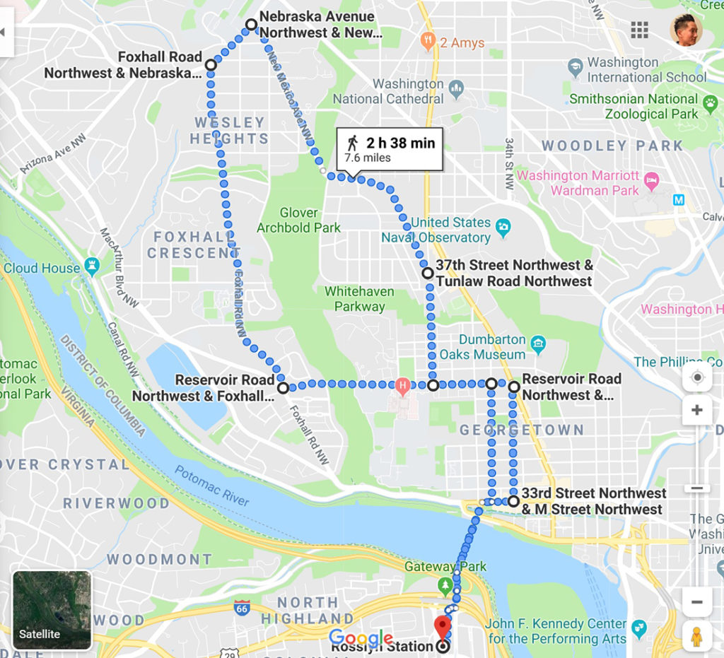
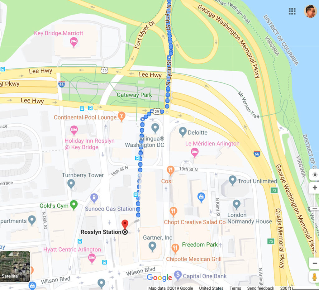
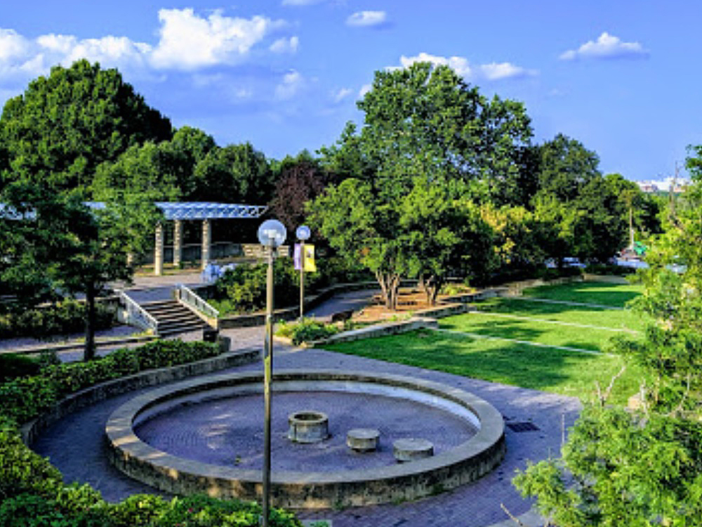
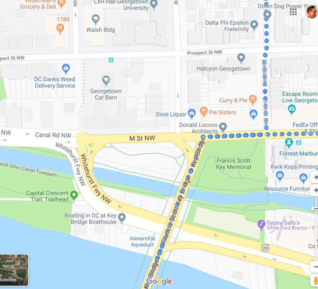
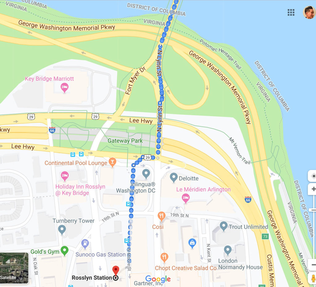
We’ll meet up at the Rosslyn Metro at 2pm. Then we’ll ride north on N. Moore Street NW for 0.1 miles, at 2:30pm. Once we come across Lee Highway, we’ll make a right and ride for 100 feet and turn left on N. Lynn Street. Immediately, we’ll see Gateway Park on the left.
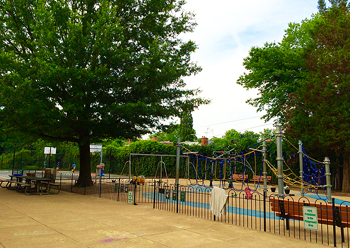
Gateway Park is the site of the Rosslyn Jazz Festival in September and other events throughout the year. The park features paved trails, fountains, an ornamental garden, and amphitheater. Every Friday in the summer, bring a blanket or low chairs and a group of friends to enjoy a night under the stars with your favorite movies. Movies start at dusk, but the fun starts at 5pm with games in the park, including cornhole, Giant Jenga and ping-pong. It’s a great place to watch the 4th of July fireworks and provides a nice view of Georgetown from the Skywalk. Children may enjoy a sandbox on the west side of Gateway Park.
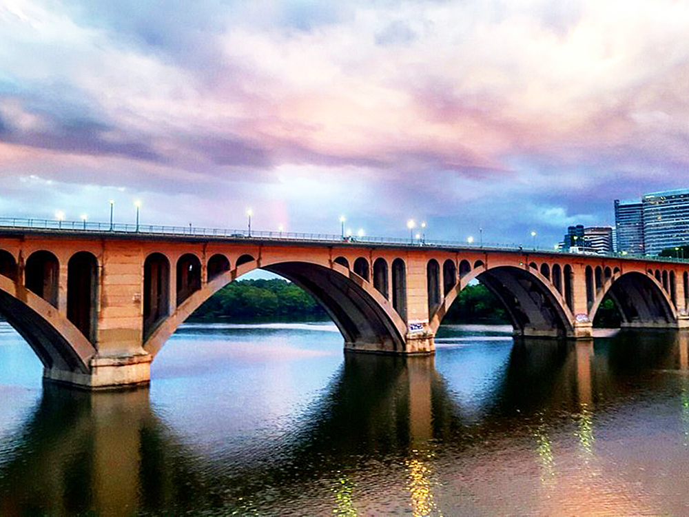
Next, we’ll continue north on N. Lynn Street for 0.3 miles. Along the way, we’ll come across the Francis Scott Key Memorial Bridge, more commonly known as Key Bridge. It is a six-lane reinforced concrete arch bridge conveying U.S. Route 29 traffic across the Potomac River between the Rosslyn neighborhood of Arlington, VA, and the Georgetown neighborhood of DC. Completed in 1923, it is DC’s oldest surviving road bridge across the Potomac River and was added to the National Register of Historic Places in 1996. The northern terminus of the bridge is just east of the site of Francis Scott Key’s home, which was dismantled in the late 1940s.
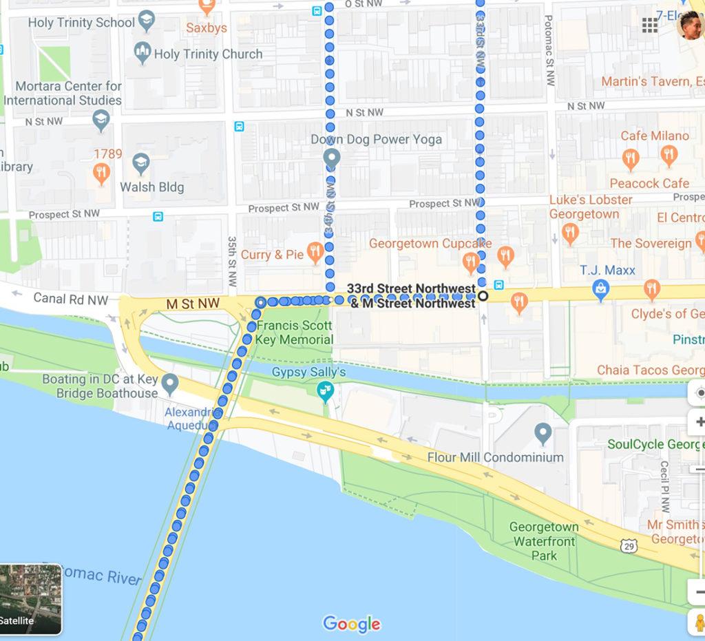
When we arrive at M Street NW, we’ll turn right, going east for 2 blocks (0.1 miles). Then we’ll turn left on 33rd Street NW, going north for 0.5 miles. Right after we turn right on M Street NW, we’ll come across the Francis Scott Key Memorial.
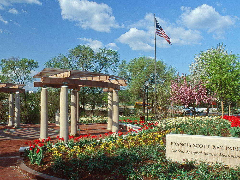
The Francis Scott Key Memorial is a park and memorial. This 0.77 acre site is a part of Rock Creek Park, but is not contiguous with that park. The park was dedicated to Francis Scott Key, author of “The Star-Spangled Banner,” and donated by the Francis Scott Key Foundation to the National Park Service in 1993. At the center of the park is a brownstone brick plaza covered by a limestone pergola draped in wisteria. The centerpiece is a bronze bust of Francis Scott Key. To the sides are interpretative signs. Within the park flies a 15-star, 15-Stripe replica of the flag that flew over Fort McHenry when Key wrote The Star-Spangled Banner. Francis Scott Key and his family lived in a house practically bordering the contemporary memorial from circa 1805 to 1830. After serving as a series of private businesses, the house was eventually dismantled and stored at the location of the memorial in 1947 for the construction of the Whitehurst Freeway.
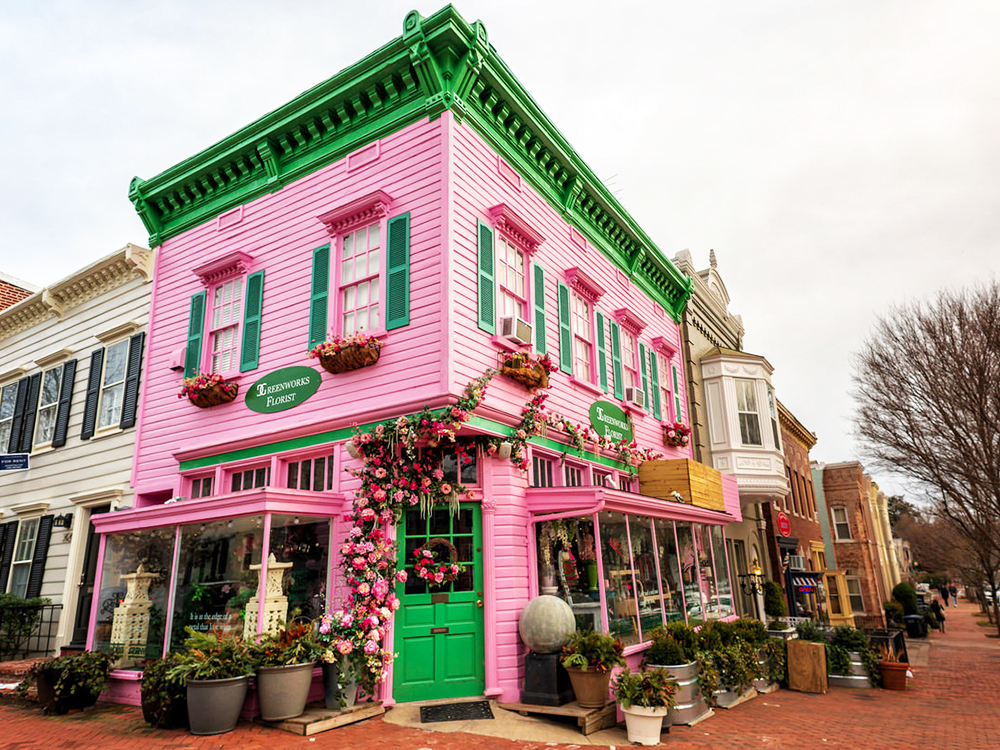
We are now in the middle of the Georgetown residential neighborhood (intersection of Volta Place NW). Georgetown is a historic neighborhood and a commercial and entertainment district. Founded in 1751 in the Province of Maryland, the port of Georgetown predated the establishment of the federal district and the City of Washington by 40 years. Georgetown remained a separate municipality until 1871 when the United States Congress created a new consolidated government for the whole of DC. A separate act passed in 1895 specifically repealed Georgetown’s remaining local ordinances and renamed Georgetown’s streets to conform with those in DC. Georgetown is home to the main campus of Georgetown University and numerous other landmarks, such as the Volta Bureau and the Old Stone House, the oldest unchanged building in Washington. The embassies of Cameroon, France, Kosovo, Iceland, Liechtenstein, Mongolia, Sweden, Thailand, Ukraine and Venezuela are located in Georgetown.
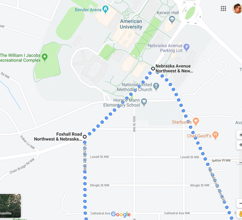
When we reach Wisconsin Ave NW, we’ll turn left and travel north 1 block. We’ll then immediately turn left on Reservoir Road NW and ride west for 1 mile.
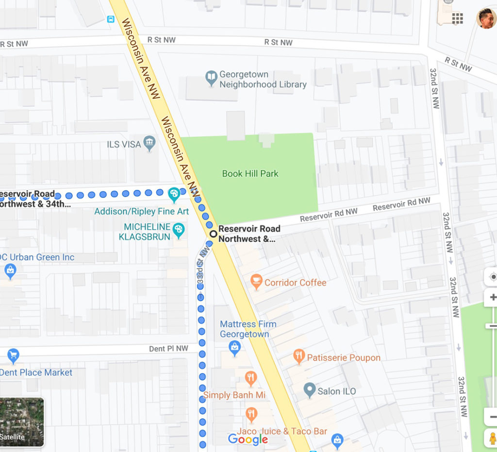
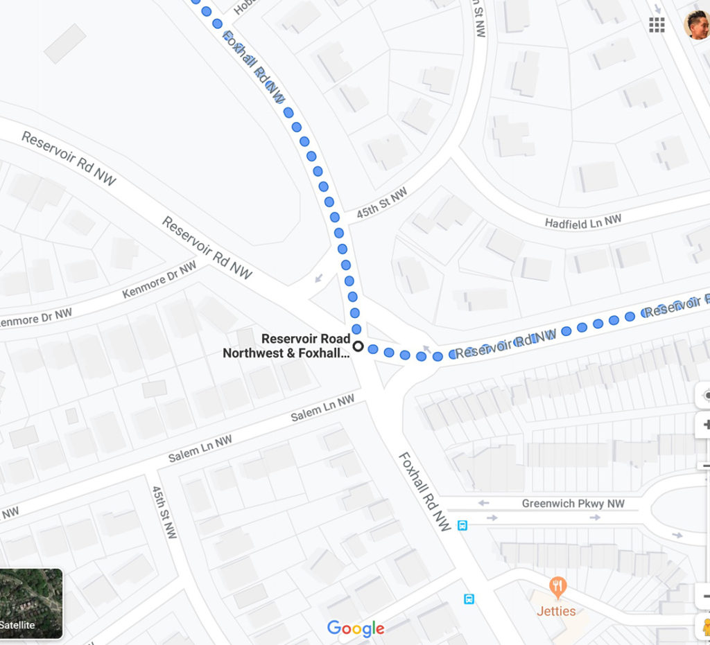
When we reach Foxhall Road NW, we’ll make a right and ride north for 1.5 miles.
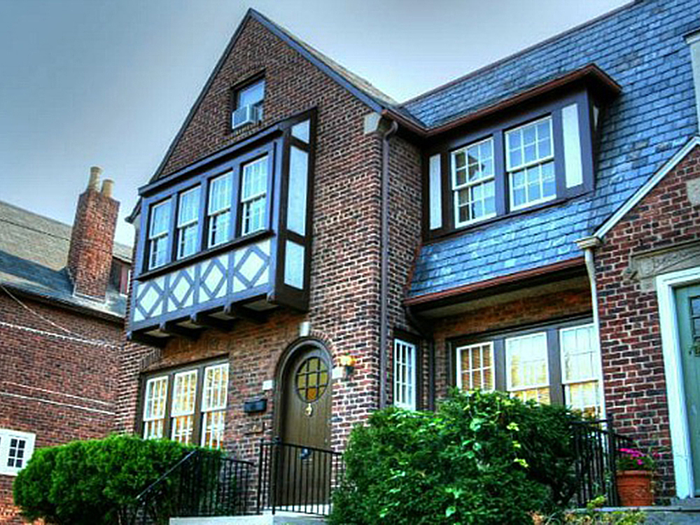
We’re now in the Foxhall Village neighborhood. The first homes were constructed along Reservoir Road and Greenwich Park Way in the mid-1920s, and primarily targeted government workers, who tended to purchase the homes for between $7,000 and $9,000. Foxhall is mostly residential. Architecturally Foxhall is distinct, because the vast majority of the homes are a brick Tudor style. It was listed on the National Register of Historic Places in 2007. The appeal tends to revolve around the well-kept greenery and the fact that the neighborhood is a short bus ride or drive from downtown yet secluded enough to be off the beaten path. The neighborhood resembles an English village, and that’s no accident. The inspiration is the town of Bath, which one of the original builders had visited and wanted to bring to Washington. The name Foxhall actually comes from Henry Foxhall, a friend of Thomas Jefferson who owned a farmhouse in the community and also the canon foundry west of Georgetown.
Along the way, we’ll pass by the Foxhall Crescent neighborhood (intersection of Foxhall Crescents NW). Foxhall Crescent is a neighborhood that mostly features large homes that are high value. This community dates back to 1925 and has a population of 4,308. Living in Foxhall Crescents offers residents an urban feel and most residents own their homes. In Foxhall Crescents there are a lot of bars, restaurants, coffee shops, and parks. Many young professionals and retirees live in Foxhall Crescents and residents tend to be liberal. The public schools in Foxhall Crescents are highly rated.
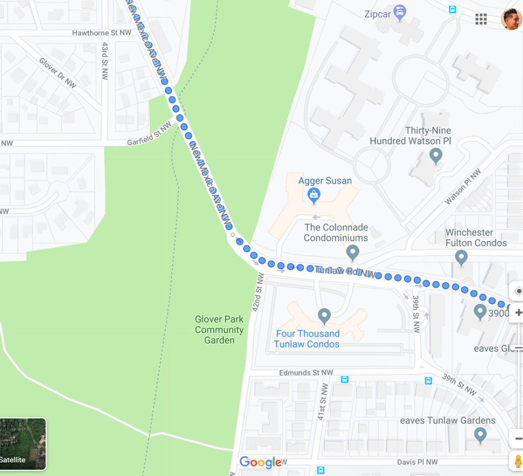
Also along the way, we’ll pass by the Wesley Heights neighborhood (intersection of Hawthorne Street NW). Wesley Heights is an affluent neighborhood developed in the 1920s by W.C. and A.N. Miller, who also developed the neighboring communities of Spring Valley and American University Park. It was one of the first master planned communities in the U.S. It remains a residential enclave of principally large detached homes with some condominium and townhouse options as well. The neighborhood is served by a small commercial mall on New Mexico Avenue with doctors, shops, restaurants and stores.
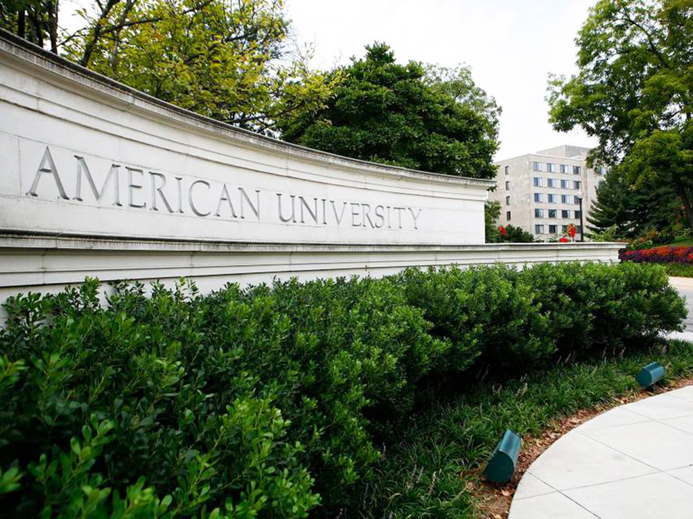
Once we reach Nebraska Ave NW, we’ll turn right and ride northeast for 0.3 miles. Then we’ll turn right on New Mexico Ave NW and ride southeast for 0.7 miles. At the corner of Nebraska Ave NW and New Mexico Ave NW is American University.
American University is a private research university and its main campus spans 90 acres at the former site of Fort Gaines. It was chartered by an Act of Congress in 1893, broke ground in 1902, opened in 1914, and admitted its first undergraduates in 1925. American University’s student body numbers over 13,000 and represents all 50 U.S. states and 141 countries; around a fifth of students are international. Its prominent alumni include numerous journalists, media personalities, ambassadors, and Congress members. American University is one of the top five feeder schools to the U.S. Foreign Service and other governmental agencies. In 2018, The Princeton Review ranked American University 1st for Top Colleges with the Most Politically Active Students.
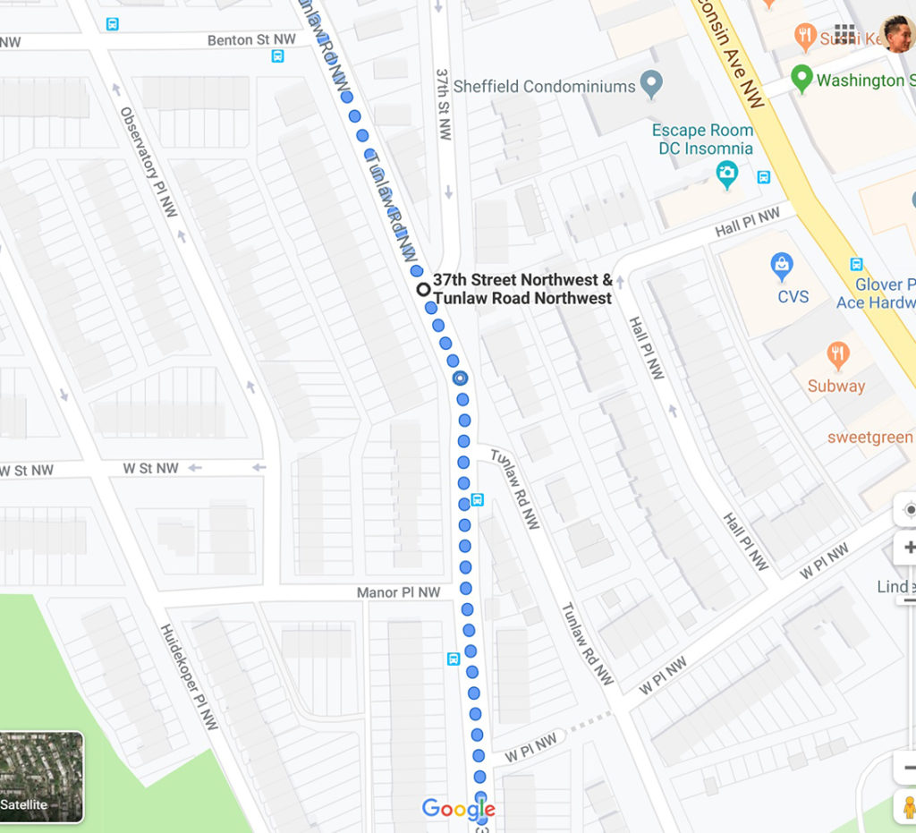
New Mexico Ave NW will turn into Tunlaw Rd NW. We’ll continue southeast for another 0.7 miles.
Tunlaw Rd NW will turn into 37th Street NW. We’ll ride south for 0.5 miles.
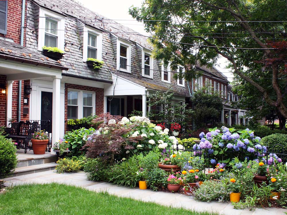
Along the way, we’ll come across the Burleith – Hillandale neighborhood (intersection of S Street NW). Burleith, a small, completely residential neighborhood that doesn’t have nearly the same name recognition as Georgetown or Glover Park, its neighbors to the south and north. If anything, it’s thought of as Georgetown-lite, a more modest version of its swanky neighbor. The neighborhood of 535 homes offers a distinctive housing stock and a quiet, more affordable way to live close to the action on Wisconsin Avenue. The housing stock offers a break from the very familiar Victorian row houses in Georgetown and Dupont Circle. All of the blocks have a recognizable look: the corners are anchored by boxy brick houses with peaked roofs and connected by modest two-story row houses, often with long, sloping roofs hanging down over the second story. The neighborhood is home to the Duke Ellington School of the Arts and the Washington International School. To the west of Burleith is a poshier 24-hour gated community called Hillandale; some consider this a separate neighborhood but it is technically part of Burleith. Residents of Hillandale have included U.S. Senators Joseph Lieberman and Ted Stevens, former NFL Commissioner Paul Tagliabue and Georgetown University President John J. DeGioia.
When we reach Reservior Rd NW, we’ll turn left and ride for 3 blocks (0.3 miles). At 34th Street NW, we’ll turn right and ride for 0.5 miles.
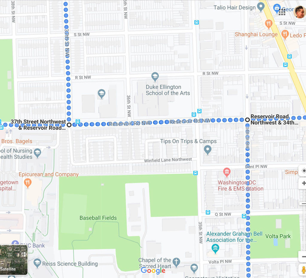
Along the way, we’ll come across Volta Park (intersection of Q Street NW). Volta Park’s rich history goes back to 1769. It was originally a cemetery where nearly 3,000 people were buried, including soldiers from the Revolutionary War, the War of 1812, and quite possibly the Civil War. At the end of the 18th century, the land was transformed into a park. Over the years, Volta Park has been touched by history. In the 1950s, John F. Kennedy played touch football there with his brothers. According to a letter addressed to a former neighbor, he first met his wife Jacqueline at a dinner party on Q Street, just west of the park. A 2400 square-foot recreation center with small swimming pool was built in 1949, and in 1979 two basketball courts and two tennis courts were added. In 2004, the D.C. Department of Parks and Recreation (DPR) rebuilt the rec center for about $400,000. In July 2013, a new $400,000 playground opened in the park.
When we reach M Street NW, we’ll make a right and travel west for 1 block. Then we’ll make an immediate left onto Key Bridge (Route 29) and ride southwest for 0.5 miles.
Once we cross Key Bridge (Route 29), we’ll veer left on N. Lynn Street heading south. Once we come across Lee Highway, we’ll turn right and ride west for 1 block. Then we’ll immediately turn left on N. Moore Street and ride 0.1 miles south back to the Rosslyn Metro.
Come join us as we spend an afternoon together exploring the sites, memorials, landmarks, and neighborhoods our ride has to offer! Please also help spread the word of our group and the ride!
I look forward to seeing you there!
– J.T.
—
METRO & PARKING
We’ll meet at the top of the escalators at Rosslyn Metro (Orange, Blue, Silver lines). I suggest taking Metro / taxi / ride-share services if you can. I also recommend using wmata.com for travel planning. Don’t forget to account for Metro, traffic, and parking delays. If you are driving, you will need to find street parking or a garage. I recommend using parkopedia.com for garage parking planning.
DRESS
Please dress appropriately for the weather. For those with problems having their feet go numb or tired during long rides, I recommend wearing shoes with a stiff and flat sole.
RIDING ETIQUETTE / RULES
Since e-wheels are relatively new technology, please be as courteous as possible to other pedestrians, bicyclists, etc. Based on personal experience (I’ve been riding daily since 2015), I’ve noticed some general good practices and rules to follow. 1) ALWAYS give pedestrians the right of way. 2) When riding on a narrow sidewalk, and you’re coming up behind a pedestrian and you need to pass them, either a) wait until there’s an opening, or b) clear your throat and say “excuse me” or “on your left” in a *gentle* manner (I’ve noticed people tend to get startled / surprised when they see and hear a tall figure behind them on a wheel) before passing them. 3) SLOW DOWN to a pedestrian’s walking pace (until you are completely clear of them) whenever approaching or passing (whichever direction they are walking). Only after passing a pedestrian for a little distance is it a good idea to go faster than walking pace. Whatever you do, please do NOT wiz by them. 4) Thank the pedestrian as you are passing. 5) Slow down as you are going around a turn (whether there are other pedestrians in sight or not) with a lot of bushes or other obstacles next to the sidewalk, as they can be coming from the other end of the turn (and not be visible initially). 6) Ride single file whenever pedestrians are around (on the sidewalk), or cars are around (in the bike lane) 7) Dismount when in the official memorial areas, such as the FDR Memorial (it’s the law)
RIDING SKILL
For the safety of others and ourselves, we will all be required to be able to perform all of the following: (1) comfortably balance on the wheel while riding straight and turning left or right (2) ride at a snail’s pace and (3) start and stop comfortably without the need to hold onto any wall, post, or similar structure.
LEGALITY
People have asked me questions regarding the laws pertaining to riding our e-wheels in the DC metro area. I did a lot of research before purchasing my e-wheel to ensure I could make use of it. In short, they are considered Personal Mobility Devices or Electric Personal Assistive Mobility Device. (1) Virginia: “An electric personal assistive mobility device or motorized skateboard or foot-scooter may be operated on any highway with a maximum speed limit of twenty-five miles per hour or less. An electric personal assistive mobility device shall only operate on any highway authorized by this section if a sidewalk is not provided along such highway…” See link here. (2) Washington DC: “Personal Mobility Device (“PMD”) means a motorized propulsion device designed to transport one person, OR a self-balancing, two non-tandem wheeled device, designed to transport only one person with an electric propulsion system. Permitted on Sidewalk – Yes, except PMDs are generally not permitted on sidewalk space in the Central Business District. Permitted on Bike Lanes – Yes.” See link here. (3) Maryland: “‘Electric personal assistive mobility device’ or ‘EPAMD’ means a pedestrian device that: (1) has two nontandem wheels; (2) is self-balancing; (3) is powered by an electric propulsion system; (4) has a maximum speed capability of 15 miles per hour; and (5) is designed to transport one person” and “At an intersection, a person using an EPAMD is subject to all traffic control signals, as provided in §§ 21-202 and 21-203 of this title. However, at any other place, a person using an EPAMD has the rights and is subject to the restrictions applicable to pedestrians under this title.” De jure, the law applies to devices with 2 wheels, as the law was written when only Segways existed and electric unicycles, et al. did not. De facto, for practical purposes, and based on our members’ interaction with law enforcement officers thusfar, our devices have been treated as being covered under this statute (they are explicitly covered under DC and Virginia law). See link here and here. “Green” devices for the win!
RAIN
If there’s a greater than a 35% chance of rain, we’ll cancel or reschedule. I’ll post an update to the top of the event posting by 11:30am on the day of the event, and also send an email out to the yes RSVPs.